
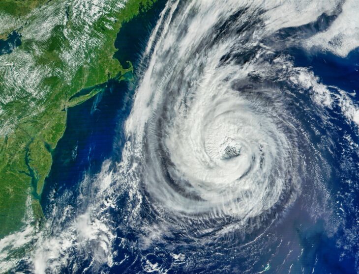
Hurricane Erin exploded into the Atlantic’s first hurricane of 2025 this weekend, rapidly intensifying to a Category 5 monster with winds reaching 160 mph on Saturday. The storm has since weakened slightly to Category 4 status with winds around 130 mph. According to the National Hurricane Center, Erin is expected to grow even larger in the coming days.
The storm’s remarkable development was captured in satellite imagery from Colorado State University’s Cooperative Institute for Research in the Atmosphere and NOAA. These images reveal intense lightning activity as Erin strengthened to Category 5. CNN Weather reports that Erin ranks among the fastest intensifying storms ever recorded in Atlantic history.
Stunning imagery of lightning within Hurricane Erin.
Stunning imagery of lightning within Hurricane Erin.
Erin remains a powerful, major hurricane. pic.twitter.com/0f4KSfNuo3
— CIRA (@CIRA_CSU) August 16, 2025
NOAA’s hurricane hunters flew directly into the storm despite the dangerous conditions. “As #HurricaneErin became a category-5 storm, we were there. Last pass of this flight, but we’re not done yet — our mission to protect the American people continues, as always!” the team posted on Instagram alongside dramatic footage from inside the hurricane.
The storm’s impact extends far beyond its immediate path.
While Erin isn’t forecast to make landfall in the United States, its effects are already being felt along the coast. Officials in North Carolina have declared local states of emergency and ordered evacuations in some areas. According to Fox Weather, authorities are “warning of life-threatening surf and rip currents at beaches up and down the East Coast from Florida in the Southeast through the mid-Atlantic, Northeast, and New England.” The Bahamas, Bermuda, and Atlantic Canada are also bracing for dangerous ocean conditions.
The storm is generating massive waves that could reach extraordinary heights. “The latest forecast does indeed indicate that the largest significant wave height could reach values in excess of 50 feet with an associated most likely largest wave of more than 100 feet,” Jean Bidlot, an ocean and earth system modeling scientist at the European Centre for Medium-Range Weather Forecasts, told Newsweek.
This #FullDiskFriday, NOAA’s #GOESEast satellite has a great view of #HurricaneErin over the Atlantic. #GOES19
See more of our corner of the world from @NOAA satellites here: https://t.co/tpyBVI6oDW pic.twitter.com/FHQLXyQDll
— NOAA Satellites (@NOAASatellites) August 15, 2025